EXPLANATION OF SCANS / PHOTOGRAPHS
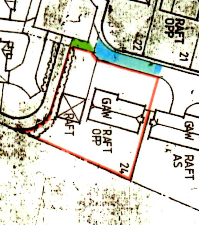
Boundary 1 – Original map from solicitors showing property boundary.
Boundary 2 – Zoom in on our property and boundary with public footpath alongside.
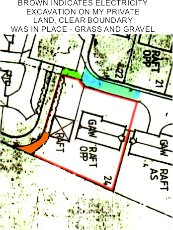
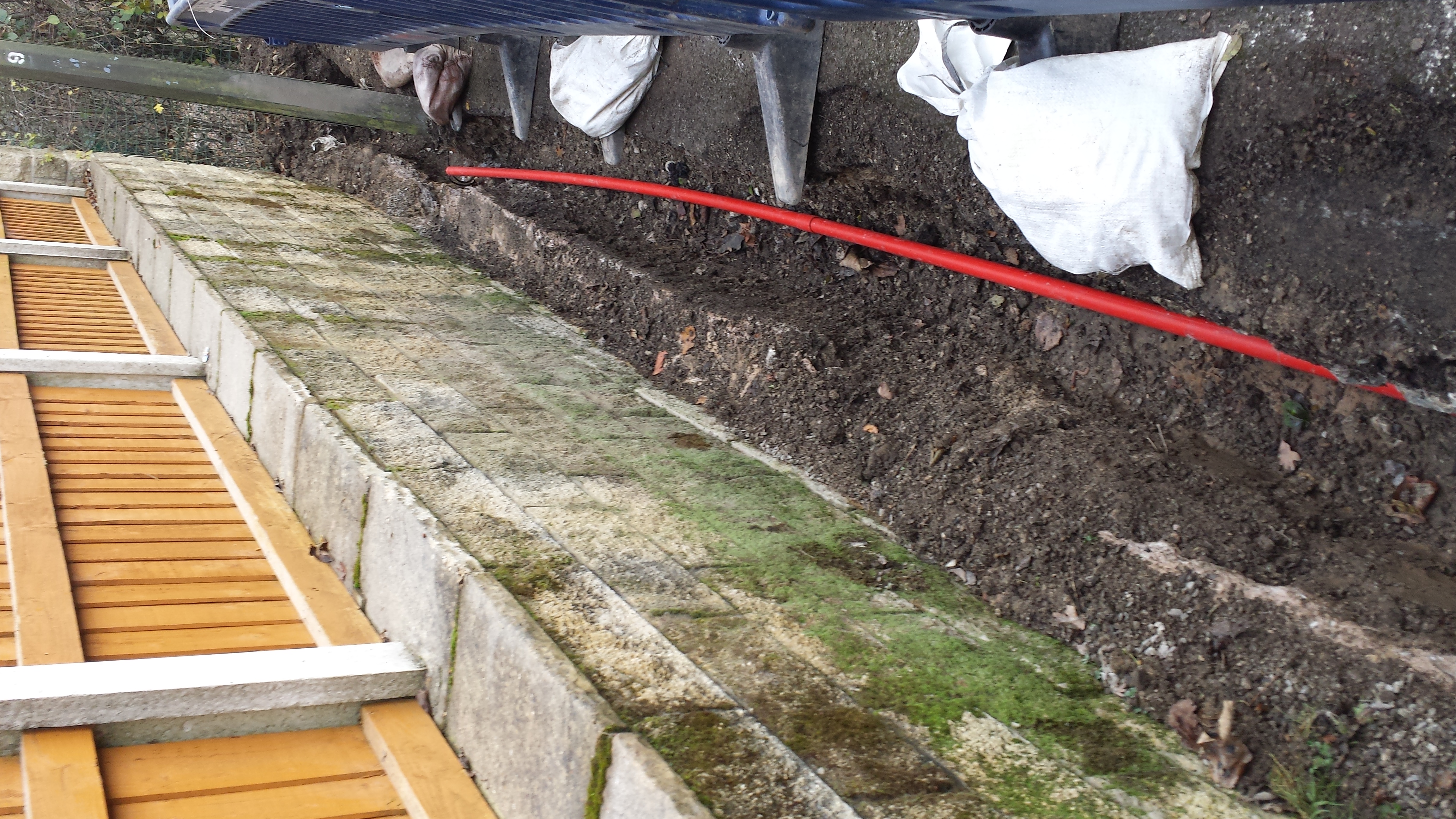
Excavation 1 – showing where the electricity board have excavated on our property, without permission.
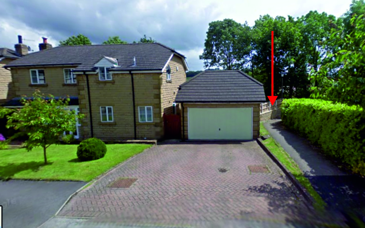
Boarder 3 (from google maps)- showing our house in relation to public path and clearly showing our boundary. Arrow marks location of excavation.
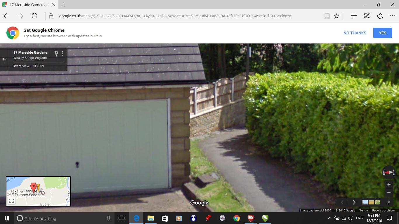
Boarder 4 (from google maps)– zoom in on path showing original condition with grass area, gravel and curb marking the limit of our property.
our_land_excavated1- extent of our land that has been excavated without permission
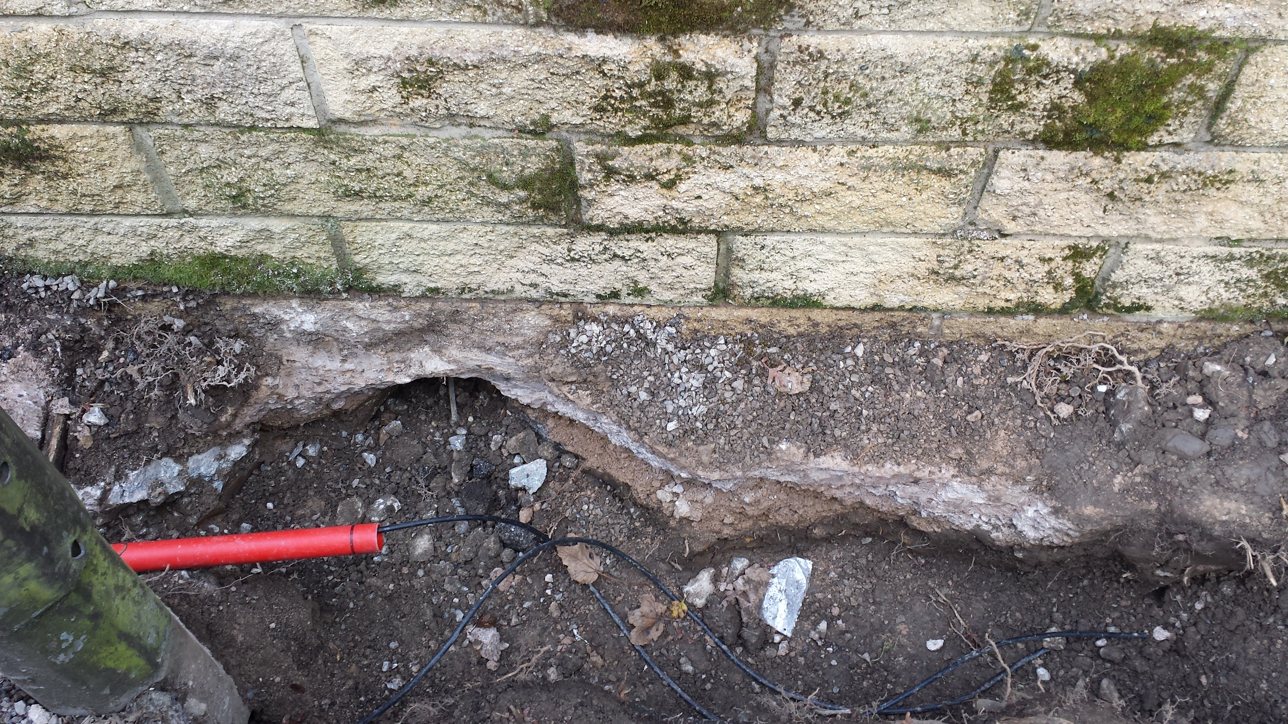
foundations_damage – significant damage to foundations of wall, undercutting our stone wall.
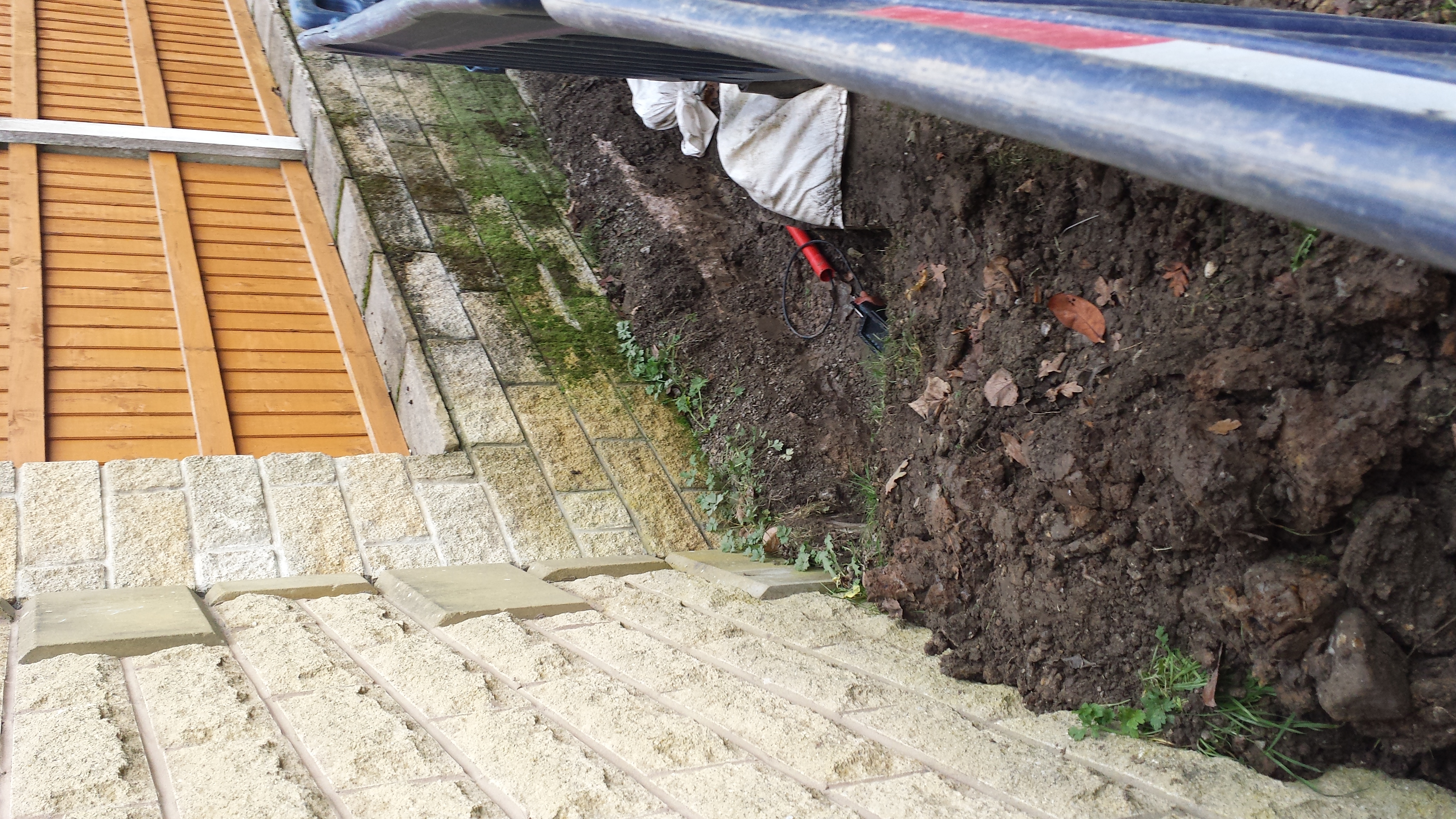
excavations_garage1 – Clearly showing our property, it’s boundary and excavations.
alongside_ourgarage1 – Shows extent of excavations on our property.