|
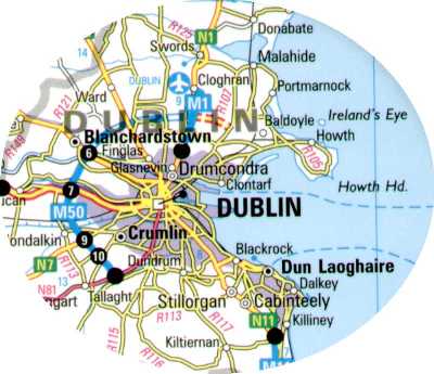
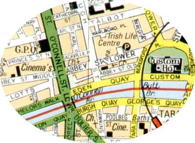
Study the two maps. Map 1
is a general map of Dublin, Eire and Map 2
shows part of the city centre. (What is another name for the country
Eire?)
The population of Dublin is over one million and like most capital
cities there is a transport problem. Quite simply, during rush hour
periods (morning and evening) traffic congestion is so bad that
occasionally traffic comes to halt.
After many years of research it has been decided to design and build a
new bridge to cross the River Liffey - this should help traffic cross
the river, reducing congestion. The new bridge will be sited somewhere
between O’Connell Street and Beresford Place. |
|
1. Locate the two roads using map 2.
2. Draw a topological map showing the exact location of the new bridge.
and explain your choice of location.
3. Design a bridge that will allow vehicles and pedestrians to cross the
bridge safely. Look at different designs before you decide on your final
choice. Include facilities such as a visitors shop, viewing platform,
cafes etc...
4. Design a leaflet aimed at attracting tourists to visit the bridge.
You may wish to:
A. Mention the extra facilities the bridge has to offer.
B. Include a drawing of the bridge.
C. Include a topological location map of the bridge.
5. What are you going to call the bridge? |

